DAVAO CITY (MindaNews /17 January) — The eruption of Camiguin island’s Mt. Hibok-hibok in 1951 gave the country what is now the Philippine Institute of Volcanology and Seismology (Phivolcs).
According to the Phivolcs, the violent eruption of Hibok-hibok volcano1951 which killed at least 3,000 persons and caused extensive damage “made the nation realize the necessity to seriously monitor and conduct studies on active volcanoes in the country.”
Mt. Hibok-hibok is listed by Phivolcs as one of 24 active volcanoes in the Philippines. In Mindanao it is one of eight.
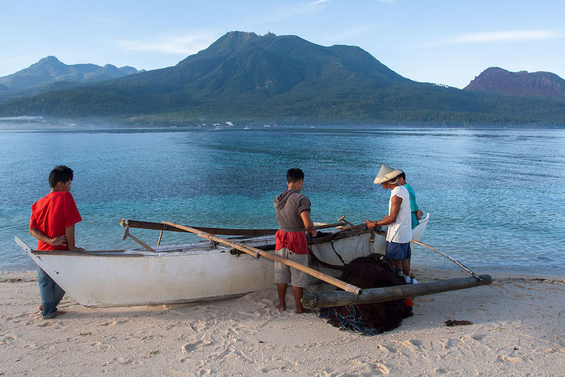
 The eruption of Mt. Hibok-hibok in Camiguin in 1951 gave birth to what is now the Philippine Institute of Volcanology and Seismology. MindaNews photo by BOBBY TIMONERA
According to the website of the Camiguin provincial government, the volcano “constantly rumbled and smoked” from 1948 to 1951. A minor eruption in 1948 caused little damage and loss of life; in 1949, its eruption caused 79 deaths due to landslides and in the morning of December 4, 1951, when the volcano erupted again, “it unleashed boiling lava, poisonous gases, and landslides enough to destroy nearly 19 square kilometers of lands particularly in Mambajao. All in all, over 3,000 people were killed.”
The website also notes that before Hibok-hibok’s 1951 eruption, the population of Camiguin was 69,000. After the eruption, it dropped by half — to 34,000 — due to massive out-migration. (Camiguin’s population as of the 2015 government census is 88,478)
A major producer of abaca then, Camiguin was part of Misamis Oriental, elevated into a sub-province by 1958 and a separate province by 1966 although it was formally inaugurated in 1968.
From ComVol to Phivolcs
The series of eruptions from 1948 prompted the post World War II government to create a body that would monitor and study the country’s active volcanoes. Republic Act 766, passed on June 20, 1952 during the administration of President Elpidio Quirino, created the Commission on Volcanology (ComVol) primarily to “safeguard life and property against volcanic eruptions and its dangers.”
ComVol was mandated to “investigate and conduct studies of all active Philippine volcanoes; establish necessary facilities in order to predict their eruption in advance, if possible; formulate in advance and in detail specific plans of action and of relief in the event of the eruption of any volcano; recommend to the President of the Philippines such measures as may be necessary to protect life and property in areas which may be affected by volcanic eruptions, including the declaration of certain areas as closed to human habitation or subject to regulation” and perform such other duties as may be necessary to carry out the the law’s purposes.
ComVol was initially placed under the Executive Board of the National Research Council and later under the National Science Development Board (NSDB).
In 1982, President Ferdinand Marcos issued Executive Order 784, reorganizing the NSDB and its agencies into the National Science and Technology Authority (NSTA). Comvol was restructured and renamed Philippine Institute of Volcanology (Phivolc).
In 1984, Marcos issued EO 984 transferring the Philippine Atmospheric, Geophysical and Astronomical Services Administration (PAGASA). from the Ministry of Defense to the NSTA.
Seismology or the science that deals with earthquakes, was transferred from PAGASA to Phivolc which the EO also renamed into Phivolcs.
In January 1987, President Corazon Aquino issued Executive Order No. 128, transforming the NSTA into the Department of Science and Technology. The EO also reorganized the Phivolcs was mandated to: “predict the occurrences of volcanic eruptions and earthquakes and their geotectonic phenomena; determine how eruptions and earthquakes shall occur and, also likely areas to be affected; generate sufficient data for forecasting volcanic eruptions and earthquakes; mitigate hazards of volcanic activities through appropriate detection, forecast, and warning systems; and formulate appropriate disaster-preparedness plans.”
8 active volcanoes in Mindanao; 24 nationwide
Active volcanoes, according to Phivolcs, are those that “erupted within historical times (within the last 600 years), accounts of these eruptions were documented by man, (or) erupted within the last 10,000 years based on the analyses of material from young volcanic deposits).
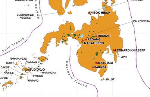
 Eight of 24 active volcanoes in the Philippines are in Mindanao. (Phivolcs)
Phivolcs listed 24 active volcanoes, eight of them in Mindanao: Bud Dajo in Sulu; Hibok-hibok in Camiguin; Leonard Kniaseff in Compostela Valley (formerly part of Davao del Norte); Makaturing in Lanao del Sur; Matutum in South Cotabato; Musuan (Calayo) in Bukidnon; Parker in South Cotabato; and Ragang in Lanao del Sur / Cotabato.
The features of these eight active volcanoes in Mindanao, its type, location and last eruptions, among others, are posted on the website of Phivolcs. According to Phivolcs:
Hibok-hibok, at the northwestern end of Camiguin (9°12.2’N, 124°40.5’E), has had five eruptions, the latest from Sept. 31, 1948 to July 1953.
Leonard Kniaseff in Compostela Valley (7°22.9’N, 126°2.8′ E), has no recorded eruption but in 1995, Phivolcs conducted an emergency investigation due to the request of the Department of Tourism and Department of Interior and Local Government regional offices to verify alleged volcanic activity there.
The probers found “no sign of unusual volcanic activity such as increased volume of emitted steam, formation of new steam vents or fumaroles” and seismic data from temporary station installed at Bgy. New Leyte “showed no volcanic earthquake.”
Ragang in the boundaries of Lanao del Sur and North Cotabato (7°41.5’ N, 124°30.3’ E) has had eight recorded eruptions, its latest in July 1916.
Makaturing in Lanao del Sur (7°38.5’N, 124°20.5’E), has a record of 10 eruptions, the latest on March 18, 1882.
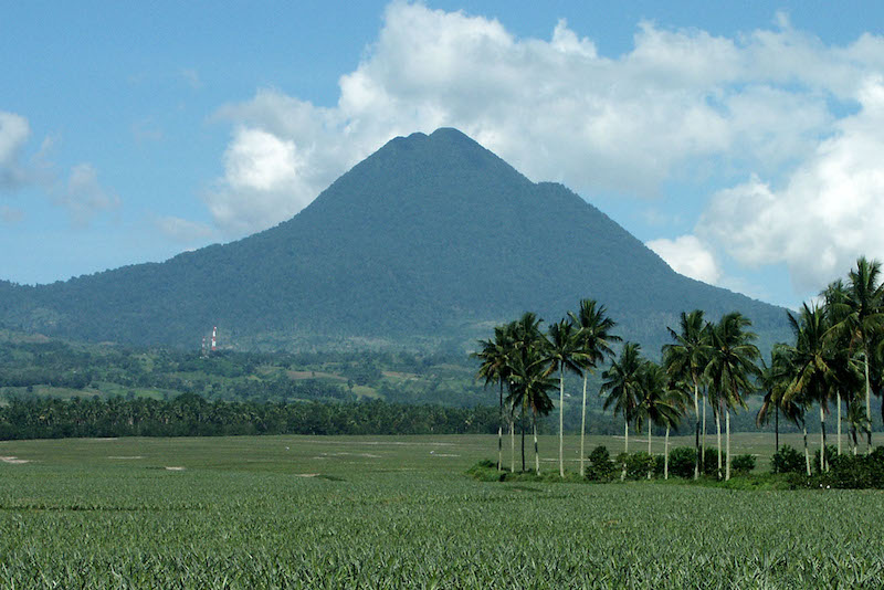
 Mt. Matutum in South Cotabato, one of eight active volcanoes in Mindanao. The Philippine Institute of Volcanology and Seismology listed 24 active volcanoes nationwide. MindaNews photo by BOBBY TIMONERA
Matutum, l15 km north of Polomolok, South Cotabato and some 30 kilometers north-northwest of General Santos City (6°22’N, 125°06.5’E), has a record of one eruption, phreatic type, on March 7, 1911.
In 1992, short-term monitoring was conducted at Matutum Volcano from November 4 to 20 but results showed the volcano was “seismically quiet.”
Parker, approximately 30 aerial kilometers west of General Santos City and 44 kilometers south of Marbel (6°06.8′ N, 124°53.5′ E) erupted once, on January 4, 1641, with pyroclastic flows, airfall tephra, lahar, lake break-out.
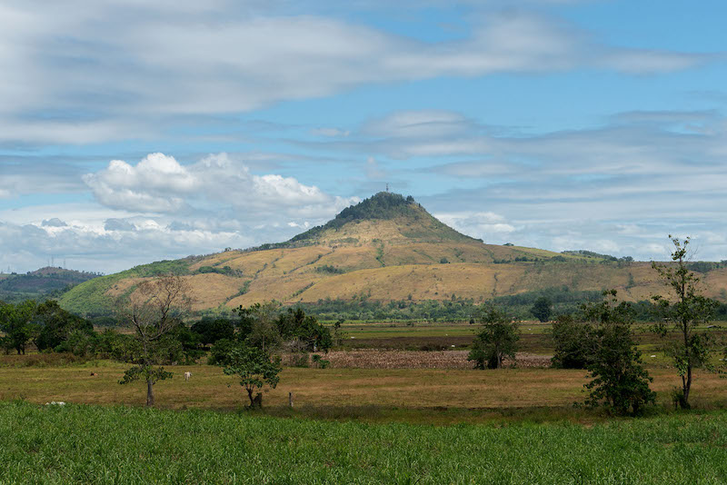
 Musuan or Calayo in Bukidnon, one of eight active volcanoes in Mindanao. The Philippine Institute of Volcanology and Seismology listed 24 active volcanoes nationwide. MindaNews photo by BOBBY TIMONERA
Musuan in Bukidnon, 4.5 km south of Valencia or 81 km southeast of Cagayan de Oro City (7°52’N, 125°04.4′ E), has erupted twice, in 1866 and 1867.
Bud Dajo in Sulu, 8.05 aerial km SE of Jolo (5° 59’N, 121°13’E), erupted twice, in 16
41 and 1897. Short-term monitoring surveys (seismic and visuals) were conducted in 1993 and in 1997 but no unusual activities were observed within the vicinity of the volcano.
The Global Volcanism Program (GVP) of the Smithsonian Institution’s National Museum of Natural History, on the other hand said Bud Dajo’s last eruption was during the Pleistocene period. It noted that a reported eruption of Bud Dajo in 1641 “actually reflected ashfall from the eruption of Parker volcano on Mindanao.”
The GVP recorded Leonard’s last eruption in 120; Ragang’s in 1873, as it classified as ‘uncertain’ the July 1916 eruption; Makaturing’s in 1882 with four reported eruptions (1856, 1858, 1865 and 1882), the last two confirmed; Matutum’s in 1290, as it cited the March 1911 eruption as ‘uncertain;’ Musuan’s in 1886 but it noted a “strong earthquake swarm” near it in 1976; Parker’s in December 1640 to January1641; and Hibok-hibok’s in 1953.
In Luzon, the active volcanoes are Babuyan Claro in the Babuyan Island Group, Cagayan; Banahaw in the boundaries of Laguna and Quezon; Bulusan in Sorsogon, Bicol; Cagua in Cagayan; Camiguin de Babuyanes in the Babuyan Island Group, Cagayan; Didicas in Babuyan Island Group, Cagayan; Iraya in Batan Island, Batanes; Iriga in Camarines Sur; Isarog in Camarines Sur; Mayon in Albay, Bicol Region; Pinatubo in the boundaries of Pampanga, Tarlac and Zambales; Smith in Babuyan Island Group, Cagayan; and Taal in Batangas.
In the Visayas, classified as active volcanoes are Biliran (Anas) in Leyte; Cabalian in Southern Leyte; and Kanlaon in Negros Oriental. (Carolyn O. Arguillas / MindaNews)
